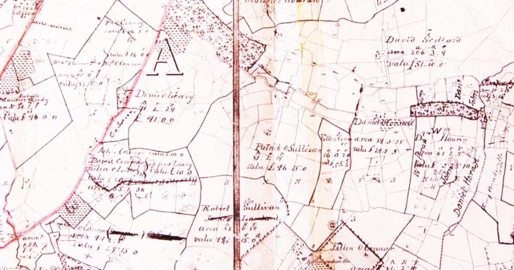
A series of farm maps of the Castleisland area complement the collection. An accompanying note describes the nineteenth century ordnance survey maps as ‘Redmond Roche’s Map’.

The maps, numbered one to six, include names, evidently land or lease holders, handwritten onto the map.1
The maps are undated. However, the Glebe House of Rev Denis Moriarty, who ministered during the period 1875-1901, is recorded therefore the map dates to this period.2

In the 1870s, Redmond Roche, senior and junior, owned over 1500 acres in Castleisland. Michael O’Donohoe’s notes on the name of Roche (IE MOD/55/55.1/55.1.246) suggest that Redmond Roche was of the family of Maglass.
Redmond Roche Esq JP of Maglass House died in November 1894 aged 55 leaving nine children. His funeral was described as ‘the largest ever witnessed in Kerry … it would be utterly impossible to give anything like a complete list of the laity present’. He was buried at Kilsarkan.

The Maps
Map 1 (IE MOD/27/27.1)
Boundaries, perhaps farm boundaries, have been marked in pink highlighter
Map 2 (IE MOD/27/27.2)
Boundaries, perhaps farm boundaries, have been marked in pink highlighter. The townland of Glanshearoon is coloured in with highlighter; this area contains the names of Maurice, Jeremiah and Honoria Keliher and others
Map 3 (IE MOD/27/27.3)
Map illustrates Castleisland town section of map 1
Map 4 (IE MOD/27/27.4)
Map of the townland of Dooneen includes Woodview Cottage
Map 5 (IE MOD/27/27.5)
Map of the townland of Lackanoneen and adjoining townlands
Map 6 (IE MOD/27/27.6)
Map of the townland of Fahaduff and a section of adjoining Dooneen townland
______________________________
1 What appears as a stamp, 'David & Daniel Loughnane, Ac 81.2.13 Val 73.10.0' may have relevance.
2 Further reference to the clergy in Castleisland in IE MOD/15.  See also The Church of Ireland in Co Kerry: a record of church & clergy in the nineteenth century (2011).


